0 km. The route starts at the crossroads between the Castelldans road and the other one towards Albagés, move in the direction of L'Albages.
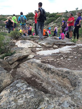
0.5 km. You will reach the cave paintings. After visiting, continue along the same path.
1.8 km. Before you reach a cabin on the left, there will be rocks on the right, at the top, where the tombs of the Saladar are.
5 km You will arrive at the road from Castelldans to Albagés, following the road on the right.
5.4 km. After a few bends in the road, you will see a wide path that goes to the left, which you should take. On the right, there will be the Set river bridge.
13.5 km. You will find a path on the left, leading to the village of les Besses and the hermitage.
13.6 km. Continue on the main road. On the right, there will be a path, leading to an area with tables near the river.
17 km. Continuing on the main road, you will skirt Cervià (on the right), and you will reach the entrance to Cervià. Continue straight along Carrer d'Anselm Clavé until the end.

17.5 km. As you leave the village,  there is a tarred path on the right. It leads to La Pobla de Cérvoles. Follow this road.
18.7 km. Take a left turn. On the left hand side of the path you will see the river Set.

20.2 km. There is a fork in the path. Take the road on the right.

22.5 km. You will reach a crossroads. The left road leads to the road from Albi to Cervià. You must follow the path that goes straight.

23.4 km. You will exit onto the road from Albi to Cervià. Go to the right.

24.8 km. After the highway sign, bear right and leave the main road to take a tarred section that takes you into the village. To the left of the highway sign you will find a sign for the cave paintings of the Coma valley; this sign refers to another route, independent of that of the river Set. Follow the tarred street, which will take you to a small bridge inside the village. Cross it and  you will see a hermitage below.

25.4 km. Go along the left side of the hermitage and in the distance you will see a path. Take this path.

25.8 km. (On the left you will see some buildings). Continue along the main road to the right.
26.1 km. You will find a fork in the path. Take the road on the right.

26.5 km. You will find a fork in the road. Take  the right turn.

28.6 km. You will find a narrower path that joins on the right. To go to Vilosell you must continue straight. But, if you go to the right just over a kilometer, you will see Cintet cave or Fosca cave and la font de la Teula (spring), where the river  Set flows.

28.8 km. You will find a fork in the path. Take the path on the left.

31.2 km. The road branches out to the left. Continue to the right on the main road.

31.5 km. You will see a path to the right with a sign that says "PV". You must continue on the main road.

31.7 km. If you continue straight on the road you will come to a sharp bend. Follow the path by the Virgin Mary (there are two roads on the left hand side that you should ignore).

32.25 km. You will come out onto a street. Go to the left. Follow the street with streetlights on your left.

32.5 km. You will arrive at the Vilosell road in La Pobla de Cérvoles. Go across the village and continue along the road in the direction of La Pobla de Cérvoles.

34 km. You will find a very wide path on the left, before the bridge crossing over the river Set. Leave the road and take this path.

36,1 km You will arrive at Sant Miquel de la Tosca. The terrains of Vilosell and Pobla de Cérvoles are divided by the river Set. Once you are at the hermitage, if you take a path below (next to the route sign), it will take you to the fountain with seven outlets.
Subscribe to our cultural agenda
Oficina Comarcal de Turisme
Av. de Francesc Macià, 54
Les Borges Blanques
25400 LLEIDA
973 142 658
turisme@garrigues.cat